")
")
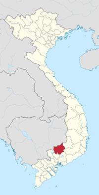 |
| BINH PHUOC PROVINCE Coordinates: 11°45′N 106°55′E Region Southeast Capital Dong Xoai Area 6,871.5 km2 Population (2011) • Total 905,300 • Density 132/km2 Demographics • Ethnicities Kinh, Xtieng, Nung Tay, Khmer, M’Nong Calling code 0651 Website www.binhphuoc.gov.vn |
Binh Phuoc Province is relatively flat with elevations of between 50m and 200m throughout most of the provinces. Elevations are gradually higher towards the east of the province and reach around 500m near parts of the border to the Dak Nong Province of the Central Highlands. The highest elevation is Ba Ra Mountain (736m) in the centre of the province. There are several hills around the province with heights of up to around 200m in the west and 300m in the southeast.
Most of the rivers in the province are tributaries of Be river, which in turn is a tributary of the Dong Nai River. Thac Mo Lake is a large artificial lake in the east of the province. Several rivers originating from the Central Highlands flow into it, including Dak Glun, Dak Nhau, Dak Rlap, and Dak Oa (from north to south). It is the point of origin of Be river, which flows through much of central and western Binh Phuoc.
Climate
There are no cold winters in Binh Phuoc. The annual average temperature is 27oC. The rainy season lasts from May to October and the dry season lasts from November to April next year.
Tourism
Binh Phuoc has many potential landscapes and vestiges. They are Mo Waterfall, Ba Ra Mountain, Waterfall No. 4, Bau Lach grass field. The historic sites are Mien military committee, Loc Hoa and Loc Quang fuel dumps. The first communist party cell of Mekong Delta was born in Phu Rieng commune, Phuoc Long District. Other famous sites include Soc Xiem and Suoi Lam tourist areas, Bu Gia Map National Park, Bombo Village.
The main ethnic groups living in that province are the Kinh, Xtieng, Hoa, Khmer, Tay and Nung. The interesting traditional festivals are Xtieng's praying for rain and New Rice Festival of the M'Nong.
Transportation
Transportation is mainly by road. The National Highway No.13 links to Ho Chi Minh City, Chon Thanh, An Loc, Loc Ninh districts then Hoa Lu border gate crossing which to Cambodia. The National Highway No.14 connects Chon Thanh with Dong Xoai Town then Gia Nghia, Buon Ma Thuot.
Last updated on 2022-04-24 22:13:49.